Let’s be honest, we’ve all been there. You pack your gear, drive an hour to the airport, and find the spotting perch perfectly aligned with… a completely silent runway. The action is all on the opposite side of the field. I’ve wasted more than a few Saturdays that way early in my spotting career. What I’ve developed since is a fast, reliable workflow—the same one I use before every trip—to predict where the action will be and if it’s worth your time.
This isn’t about complex ATC procedures; it’s about thinking like a controller. They have three main bosses: the wind, the physical state of the airport, and traffic flow programs. Let’s break down how you can listen in on that conversation before you even leave home.
1) Start with the Wind: The Primary Decider
Your first stop is always the weather. Pull up the latest METAR (current conditions) and TAF (forecast) for your airport on a source like the NOAA Aviation Weather Center. I always use the “raw” view; decoding it yourself is a vital skill.
The wind group is your golden ticket. Remember, direction is given in true degrees, and speed is in knots. Here’s the simple rule I’ve found holds true about 80% of the time: when the wind is 5 knots or more, ATC will assign the runway most closely aligned with it to give every aircraft a safe headwind component. When the wind is light and variable (less than 5 knots), all bets are off, and they’ll likely switch to a calm-wind or noise-abatement configuration.
You can get more confident with a tiny bit of mental math. Think of it as a right triangle:
- Headwind Component = Wind Speed x COSINE (Angle between Wind and Runway)
- Crosswind Component = Wind Speed x SINE (Angle between Wind and Runway)
A pilot’s goal is to maximize the headwind and minimize the crosswind. So, if the wind is 290 at 15 knots, Runway 28 (heading 280) is going to be a prime candidate. If it’s gusting from 210, suddenly Runways 21 or 22 look much more appealing.
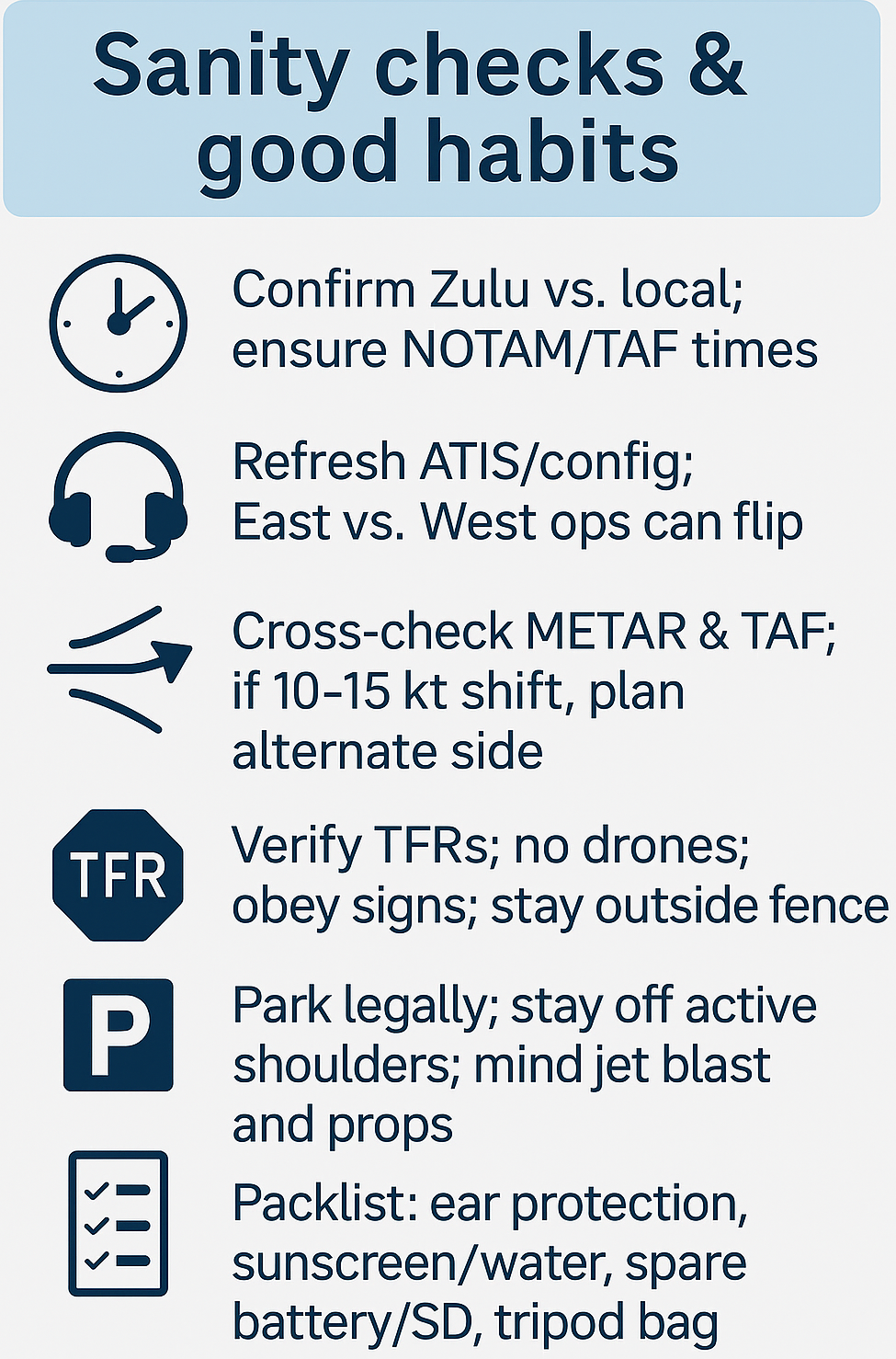
Pro-Tip from the Field: I always scan the TAF for FM (from) or TEMPO (temporary) lines. A forecasted wind shift later in the day is your heads-up that the flow might completely reverse, meaning you should plan to relocate your spot midday.
2) Decode the NOTAMs: The Reality Check
The wind gives you the plan, but NOTAMs (Notice to Airmen) are what often change it. This is where most new spotters drop the ball. Open the FAA NOTAM Search(or your country’s equivalent) and enter the airport’s ICAO code (e.g., KATL).
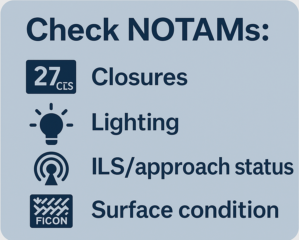
You’re scanning for a few key things in that wall of all-caps text:
Surface Conditions: In winter, this is critical. Look for FICON NOTAMs or SNOWTAMs. They provide Runway Condition Codes (RCC) from 6 (dry) down to 0 (nil braking). If one runway has an RCC of 2 and the other is a 5, you can bet they’ll concentrate all traffic on the better surface.CAO shorthand, the FAA’s format example PDF helps you translate quickly. Times are UTC/Zulu—mind your local time. FAA
Runway/Taxiway Closures: This is the big one. “RWY 09/27 CLSD” means that option is off the table, no matter what the wind says. A partial closure like “TWY B1 CLSD” can mean arriving aircraft have a longer rollout, affecting where you’ll see them exit.
Lighting and NAVAID Outages: If you see “ILS RWY 16R OTS” or “PAPI RWY 31L OTS,” it means the precision guidance for that runway is down. In low clouds, they might not use it at all. In good weather, they might, but it’s a mark against it.

A Story from San Francisco: The NOTAM That Saved the Day
I remember planning a spot at SFO for a rare easterly wind flow. The TAF was perfect, predicting winds that would put operations on Runways 1L/1R. I was already picturing the shots of heavies on the short final over the bayside. But a last-minute check of the NOTAMs showed a critical one: “RWY 01L ILS CAT I/II/III OTS. PAPI OTS.” Both precision systems were down. Even with a perfect wind, controllers were going to avoid it for all but the clearest visual approaches. Sure enough, when I listened to the ATIS, they were using the 28s with a slight tailwind, all because of that NOTAM. I ended up on the west side of the field and got great shots, while the spotters on the east side saw nothing. Always. Check. The NOTAMs.
3) Understand Runway-Use Programs: The “Why Are They Using That Runway?” Answer
Sometimes, the wind is calm and they’re using a runway that seems to make no sense. This is almost always due to a published runway-use program, usually for noise abatement or to maximize capacity during peak traffic. The FAA Order JO 7110.65 gives controllers the flexibility to do this. So, if you see a 737 taking off with a 3-knot tailwind, don’t assume the controller made a mistake—they’re likely following a noise program to keep the peace with the local community.
Your 5-Minute “Go/No-Go” Spotting Plan
- Wind: Check METAR/TAF on Aviation Weather Center. Identify the dominant direction and any shifts.
- Prediction: Use the wind rule to guess the primary runway pair.
- NOTAM Reality Check: Scan FAA NOTAM Search for closures or outages that override your wind prediction.
- Sun & Location: Use an app like Sun Surveyor to pick a spot aligned with the active runway and with the sun at your back.
- Plan B: Have a secondary spotting location in mind if the TAF predicts a wind shift later in the day.

Winter Spotting: A Quick Decode
When the snow flies, your spotting strategy changes. Focus on the FICON NOTAMs and their RCC values. A poor RCC on one runway means all traffic will be funneled to the best one. This often means longer gaps between aircraft as they increase spacing, but it also makes your photo composition more predictable. For a deep dive on decoding these, Skybrary’s page on SNOWTAM is an excellent resource.
Bottom Line
Becoming a proficient spotter is about more than just having a long lens; it’s about understanding the logic of the airport. Master the wind, religiously check the NOTAMs, and appreciate the role of noise abatement. This trifecta will dramatically increase your success rate and turn those frustrating silent days into a thing of the past.
For more on understanding the pilot’s perspective, check out our guide on Cockpit Communication, or if you’re just starting out, our Beginner’s Guide to Aircraft Identification is a great primer. To see these techniques in action, explore our gallery of Spotting Location Guides.


